


Fabien Girardin illustrates how using our digital “footprints” can be used to create rich geospatial visualistaions of urban areas.
As Fabian points out “we leave behind footprints from our interaction with the urban environment and its digital infrastructures (e.g. taking and sharing digital photos, communicating through wireless networks, withdrawing money).” These footprints when combined with other data such as grafitti, stickers and the like can be utilised to develop an alternative view of urban landscapes.
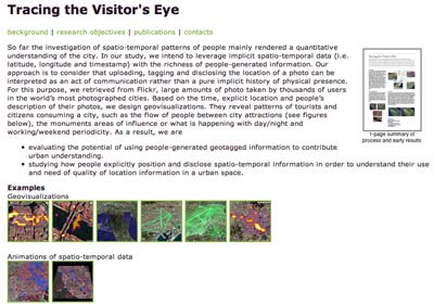
In this example Fabian shares how Flickr photo tagging, descriptions and location details could be utilised to create geovisualisations.
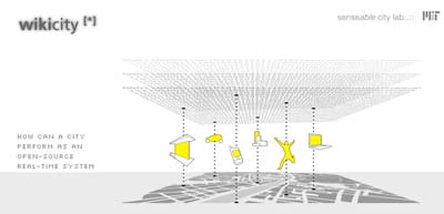
He shares another interesting example, MIT’s Wikicity project and its recent application in the city of Rome. This graphic reveals cellphone activity in Rome while Madonna was singing the song “Live To Tell”.
I cannot help but think that this idea could be simplified and utilised in the Geography classroom. Data would need to be collected, aggregated and depicted in a practical manner. How to collect the data? Which data? The ideas are still formulating. Students could collaborate. I need to think more on this.

